Mapping puddles to control malaria

Research in African wetlands is revealing crucial data that could help save lives — and it all starts with the humble puddle.
Mosquitoes need water and warmth to breed. They also carry malaria, a disease that kills over 400,000 people each year — 90 percent of them in sub-Saharan Africa.
Over the last twenty years, anti-malaria initiatives such as distributing bed nets treated with insecticide, spraying insecticide inside houses and destroying mosquito larvae have helped to reduce infection.
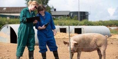
But these activities cost money, and few countries can afford to use them indiscriminately. They have to be targeted to places where mosquito populations and malaria cases are expected to be highest.
Warm and wet
Public health officials estimate how well mosquitoes are breeding based mainly on temperature. The other factor the insects need — water — is a bit more complicated.
It’s broadly assumed that mosquitoes need around 80mm of rain in a month to breed effectively. But studies into this vary widely and, according to Dr Mark Smith, Associate Professor, from the University of Leeds’ School of Geography, the reason for that is clear:
“Mosquitoes need standing water in which to lay their eggs and in which their larvae will develop, but rainfall doesn’t necessarily equal puddles,” he explains.
“In fact, some studies have shown malarial infections reducing when it rained, because the mosquitoes were breeding in puddles left in dry river beds and these were flushed out when rainfall was higher.”
Looking deeper
Dr Smith has been working with a team, including Professor Chris Thomas at the University of Lincoln and the Zambian Director of Public Health Dr Andrew Silumesii, to develop an alternative way to assess mosquito populations — one that draws on an understanding of the bodies of water within a geographical area, and how these respond to different amounts of rainfall to create the conditions that mosquitoes favour.
Much of this research has focused on the Barotse flood plain of the Zambezi river, creating models that show how much water there is in the river at any particular time, how that spreads across the landscape, where it floods and for how long.
The team ensure their hydrological models are correct by comparing them with satellite data. They have also incorporated details of where human settlements are located, which enable malaria to spread into and from the mosquitoes, and used this to determine how the mosquitoes will behave.
Drawing these different layers of data together provides a very detailed risk map, helping to pinpoint the areas where malaria is most likely to be a problem.
The impact of climate change
But this only provides a picture of what is happening now. Dr Smith and his colleagues want to be able to predict malarial outbreaks in the future — not just under current conditions but in the increasing temperatures and rainfall that will be brought about by climate change.
They’ve proved that this is possible by combining broad climate and hydrological models for the whole of Africa — to give a very general picture of where the most favourable conditions for mosquitoes will be found as our climate warms. This research has already brought up some interesting results. Dr Smith explains:
“Climate based predictions of malarial prevalence have previously relied on rainfall data and our model was broadly consistent with these, in terms of the overall amount of land across Africa that will be suitable for mosquitoes as the climate changes.”
But where that land was located differed a lot between the models. Our model showed that certain sections of rivers that aren’t currently deemed at risk, would become breeding grounds for mosquitoes in the future. And this is important, because these areas are often where towns and villages are found as well.
Details that make a difference
Although interesting, this broad overview of Africa as a whole does not have enough detail to usefully inform public health strategies at a local or national level. At the other extreme, the in-depth modelling of the Barotse flood plain requires so much work that it isn’t feasible to apply at a larger scale.
So the team plan to find the middle ground: a model that can cover a larger area such as a complete river catchment, which can analyse the distribution of water in enough detail to show areas at risk.
“There’s not an infinite amount of money to spend on malaria control, so public health officials need to know where best to spend it,” says Dr Smith.
“Our models will help them prioritise their resources in the right areas, both now and as the planet warms.”