News

PhD student awarded Piers Sellers Prize for polar science research
Tom Slater, a PhD student in the School of Earth and Environment, is one of two recipients of this year’s Piers Sellers prize.
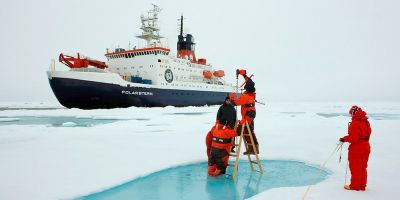
Joining the Arctic research ship ‘drifting’ past North Pole
A research ship carrying 600 international scientists, including researchers from the University of Leeds, is studying the region’s climate system.
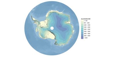
CryoSat gives best 3D view of Antarctica yet
A new map of Antarctica, available to download from today, is providing the most accurate three-dimensional view of the continent to date.
Funding Success: Dr Natasha Barlow awarded €2M ERC Starting Grant
Dr Natasha Barlow has been awarded an ERC starting grant, for a project titled ‘Rates of Interglacial Sea-level Change, and Responses' (RISeR).
Antarctica ramps up sea level rise
Ice losses from Antarctica have increased global sea levels by 7.6 mm since 1992, with two fifths of this rise (3.0 mm) coming in the last five years alone.