News

Mapping the global impact of shrinking glaciers on river invertebrates
River invertebrates react the same way to decreasing glacier cover wherever in the world they are, say scientists.
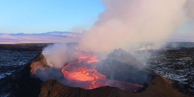
Climate change could increase volcano eruptions
Shrinking glacier cover could lead to increased volcanic activity in Iceland, warn scientists.
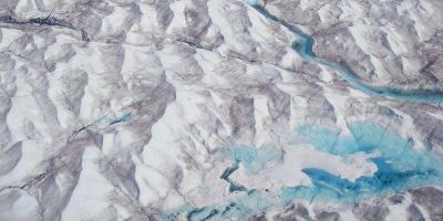
Greenland ice flow likely to speed up
Seismic surveys challenge the view that recent slowdowns in Greenland’s ice flow will continue in the long term, says a new study.

Drilling down into the mysteries of the world's highest glacier
Climate change scientists are heading to the Himalayas in a bid to become the first to successfully drill through the world's highest glacier.

Arctic Peninsula ice more stable than thought
Glacier flow at the southern Antarctic Peninsula has increased since the 1990s, but a new study has found the change to be only a third of what was recently reported.