The storm chasers making life-saving forecasts
Weather forecasters in Africa are getting access to satellite data that will allow them to track the path and severity of developing storms – and reduce the death toll from extreme weather events.
An initiative called African SWIFT has enabled meteorologists to make accurate, hour-by-hour forecasts as severe weather approaches, a technique known as 'nowcasting' – very-short-range weather forecasting. The project was led by the University of Leeds with nearly £8 million from the UK’s Government’s Global Challenges Research Fund.
Nowcasting has been used to issue alerts around the recent extreme weather in Kenya. Professor Doug Parker, Professor of Meteorology at Leeds and co-lead of African SWIFT, explained:
"The essence of a nowcasting alert might be 'there is a storm very close to you, and it is heading your way.' Users can understand this message and recognise the kinds of action they need to take. Sometimes the storm does not reach them, and sometimes it does, but the essential message we give them about the storm is correct. In this way, users gain confidence in the information from their weather service."
The technique is based on satellites monitoring changes happening in the atmosphere. It just takes 15 minutes for the information recorded in space to reach the forecasters' desks. African SWIFT involves a partnerships between the National Centre for Atmospheric Sciences at Leeds, the University of Reading, academics and researchers and meteorological agencies in Ghana, Kenya, Nigeria, Senegal and the UK's Met Office.
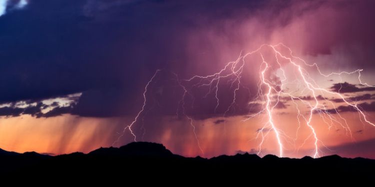
Africa’s tropical storms
Lying across the equator, the continent is prone to sudden and extreme weather but forecasting those events is difficult. It is reported that between 3,000 and 5,000 people fishing on Lake Victoria die each year after being caught in severe storms. Lake Victoria is one of Africa’s Great Lakes. Using the satellite data, forecasters will be able to see what the weather is currently doing and predict what will happen over the next couple of hours as well as after the storm, to help direct rescue and clear-up operations. Nowcasting will not only save lives but help protect the economy.
Nowcasting is common in the US, Europe and Asia where it uses data from linked rainfall-radar stations. Across Africa, however, there are very few rainfall-radar stations. Instead, African SWIFT uses information collected by satellites above Africa. The satellite data, which includes information about storm formation, is fed back to the Chilbolton Observatory in Hampshire where it is processed and then uploaded to the African SWIFT website where it can be accessed by forecasters across Africa.
Further information
Part of the African SWIFT project is to train African forecasters in nowcasting techniques – and to build nowcasting capabilities across the continent.
The UK Global Challenges Research Fund is administered by UK Research and Innovation, which fosters research across universities, the charity sector, industry and government.
Contact us
If you would like to discuss this area of research in more detail, please contact Professor Doug Parker.