Pioneering the use of satellite technology in hazard response and ground stability monitoring

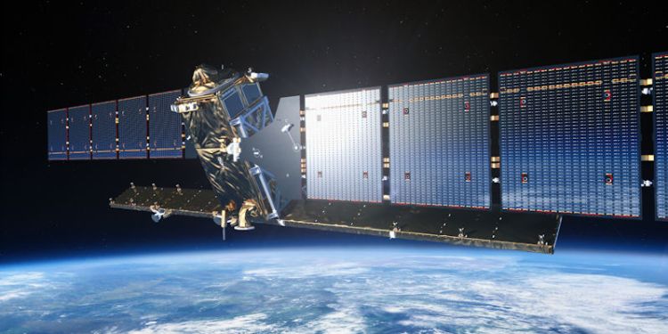
Sentinel 1 (European Space Agency 2021)
Main image credit: European Space Agency
The development of the ESA/EU Sentinel-1 satellite mission enabled scientists to pioneer the application of a type of radar imaging technology known as satellite radar interferometry (InSAR) to monitor changes to the Earth’s surface at an unparalleled level of detail. The mission has accelerated the transition towards global, continuous satellite monitoring of faults, volcanoes and ground stability.
Researchers from the School of Earth and Environment informed part of the data acquisition plan for the mission. Following its launch in 2014, they developed tools and algorithms to enable the rapid, large-scale, exploitation of data in response to natural hazards globally, and produced innovative commercial ground-monitoring solutions and services.
Professors Tim Wright and Andy Hooper, and colleagues at the Centre for Observation and Modelling of Earthquakes, Volcanoes and Tectonics (COMET), routinely deliver InSAR-derived data and models to civil protection authorities during volcanic crises and following major earthquake events, often within a few hours of the data being captured by the Sentinel-1 satellite. This provides local scientists and authorities with a detailed picture of the changes on the ground to support the event response.
Professor Tim Wright said: “Sentinel-1 has been a game changer in terms of our ability to monitor movement in our dynamic and hazardous planet – in Leeds and COMET we have built tools to ensure that results can be provided rapidly to scientists and decision makers around the planet.”
Rapid response InSAR data and models were used by local agencies to inform decisions and hazard warnings, for example, following volcanic crises in Iceland (2014-15 and 2020) and Ecuador (2017), and the earthquake in Kaikoura, New Zealand (2016). In each case tools and software developed at Leeds have been further integrated as part of national monitoring systems for use during future events.
Sentinel-1 has been a game changer in terms of our ability to monitor movement in our dynamic and hazardous planet.
Commercial applications
The spin-out company SatSense Ltd has developed commercial applications of the continuous, high resolution data stream from Sentinel-1 through the development of processing and visualisation tools. It was founded in 2018 to maximise the commercial potential of new large scale processing algorithms developed in the School of Earth and Environment.
SatSense has attracted investment from Unipart Rail and the Northern Powerhouse Investment Fund and created new specialist technical and commercial roles. “SatSense has built on algorithms developed in Leeds to build an unrivalled system,” explained Andy Hooper. “It can provide clients with live monitoring data for the whole of the UK.”
The company provides high-resolution ground stability data and precise deformation monitoring services. It also provides data and services to clients in the geotechnical, property and infrastructure sectors, who require detailed ground stability information to inform risk management decisions.
Using algorithms developed by Leeds researchers, SatSense is an unrivalled system that can provide clients with live monitoring data for the whole of the UK.
Centre of Observation and Modelling of Earthquakes, Volcanoes and Tectonics (COMET)
COMET is a National Environment Research Council (NERC) Centre of Excellence bringing together scientists from the British Geological Survey and 10 UK universities to deliver leadership and national capability science on Earth Observation, tectonics, and volcanism.
Since 2014, the COMET Directorate has been led by Professor Tim Wright and based at the School of Earth and Environment, University of Leeds. In 2018, COMET was awarded the Royal Astronomical Society Group Achievement Award.
Contact us
If you would like to discuss this area of research in more detail, please contact Professor Tim Wright or Professor Andy Hooper.

